
A VIRTUAL JOURNEY THROUGH THE ANDES MOUNTAINS
23 April 2020
A VIRTUAL JOURNEY THROUGH THE ANDES MOUNTAINS
23 April 2020
It’s reasonable to assume that worldwide travel is going to take some time to recover from the coronavirus outbreak of 2020. And, until there’s a proven vaccine made available for mass distribution, dreams of once-in-a-lifetime-trips will remain very much that. Hopeful dreams.
Not that there’s anything wrong with dreaming, of course. In fact, if you’re anything like us, researching, planning and then dreaming about your next trip is as good for the soul as anything. And, let’s face it, we could all do with some unadulterated positivity right now.
As far as we’re concerned, the Andes Mountain Range in South America would be an unbeatable once-in-a-lifetime choice. At 8900 kilometres (5500 miles) in length, from the Caribbean coast of Venezuela to the ice fields of southern Patagonia, it represents travel on a truly epic scale. In fact, if you’re a fan of the outdoors and jaw-dropping scenery, we reckon it should be at the top of your travel wish list.
And, to get you in the mood, we’ve developed an Andean photographic journey for your armchair-viewing pleasure. Running from north to south, it’s a bewildering world of jungle clad mountains, high plateaus, plunging canyons, smoking volcanoes, craggy peaks and enormous glaciers.
So grab your virtual flight ticket, pack your imaginary backpack and escape the perils of lockdown with us on this journey of a lifetime.
You can enhance the journey by following along on Google Earth. Once you’ve opened the software in a separate tab, just enter each of the location headings into the search box as you scroll through the post. You’ll soon find yourself being whisked away from your armchair high above the Andes, before dropping in for a closer look in full 3D glory.
We’ve also included links for each location within the post itself.
If you don’t have Google Earth downloaded on to your device, you can do so here – it’s free.
Páramo de Ocetá, Colombia
San Agustín Archaeological Park, Colombia
Cotopaxi, Ecuador
Laguna Paron, Peru
Machu Picchu, Peru
Colca Canyon, Peru
Lake Titicaca, Bolivia
Laguna Colorada, Bolivia
Salar de Uyuni, Bolivia
Serranía de Hornocal, Argentina
Quebrada de Cafayate, Argentina
Cordillera de Ansilta, Argentina
Parque Nacional Nahuel Huapi, Argentina
Volcán Osorno, Chile
Las Capillas de Mármol, Chile
Lago General Carrera, Chile
Mount Fitz Roy, Argentina
Perito Moreno Glacier, Argentina
Torres del Paine National Park, Chile
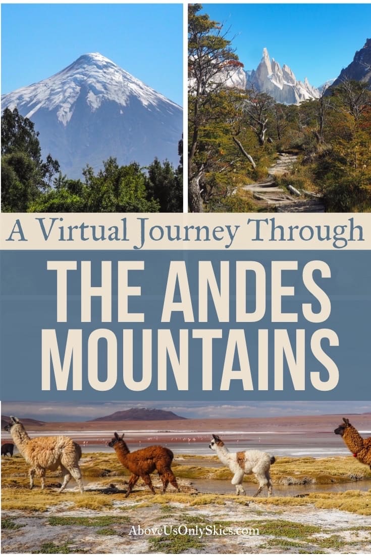
Our route through the Andes Mountains
Contents
- Páramo de Ocetá, Colombia
- San Agustín Archaeological Park, Colombia
- Volcán Cotopaxi, Ecuador
- Laguna Paron, Peru
- Machu Picchu, Peru
- Colca Canyon, Peru
- Lake Titicaca, Bolivia
- Laguna Colorada, Bolivia
- Salar de Uyuni, Bolivia
- Serranía de Hornocal, Argentina
- Quebrada de Cafayate, Argentina
- Cordellira de Ansilta, Argentina
- Parque Nacional Nahuel Huapi, Argentina
- Volcán Osorno, Chile
- Las Capillas de Mármol, Chile
- Lago General Carrera, Chile
- Mount Fitz Roy, Argentina
- Perito Moreno Glacier, Argentina
- Parque Nacional Torres Del Paine, Chile
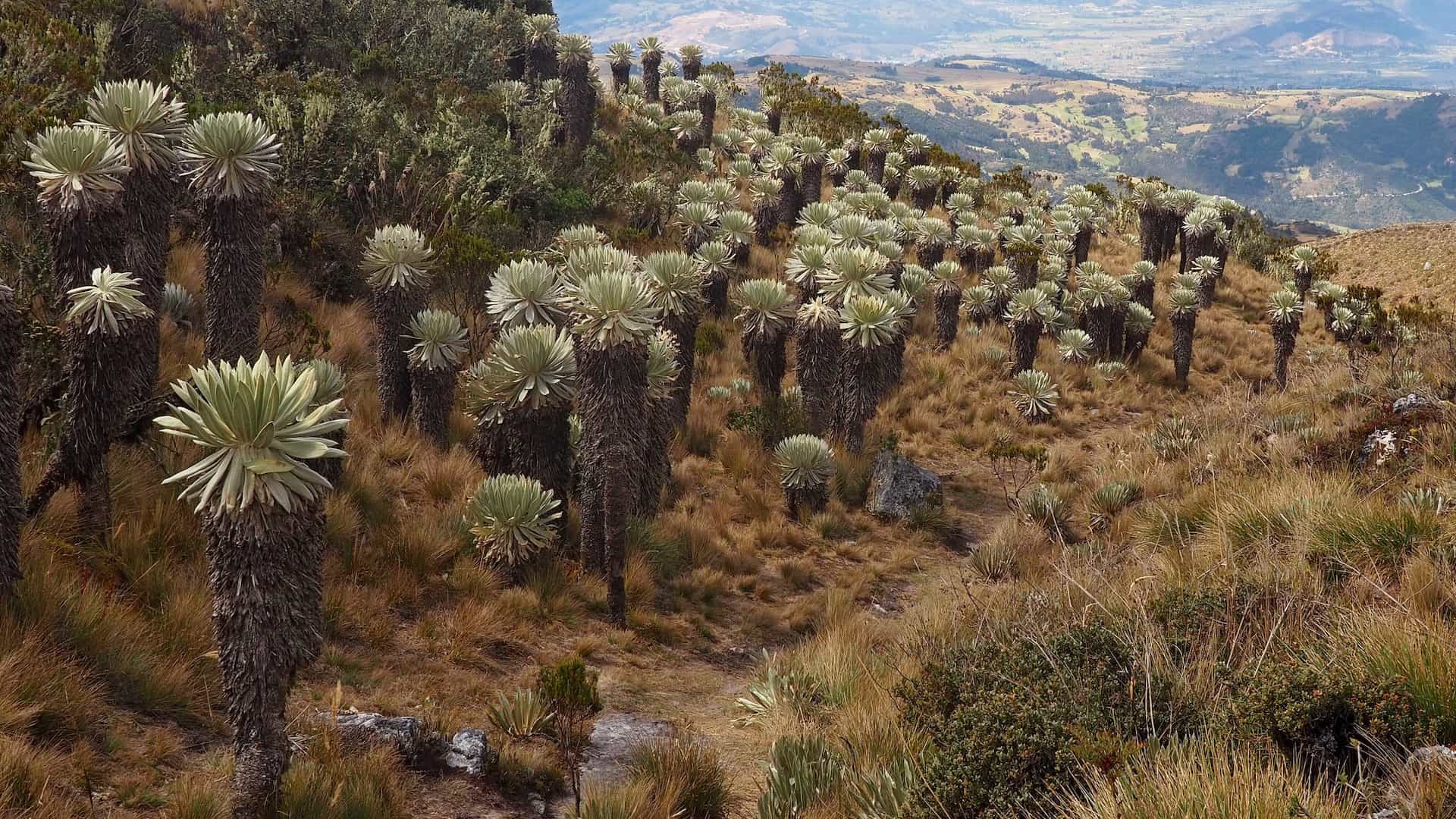
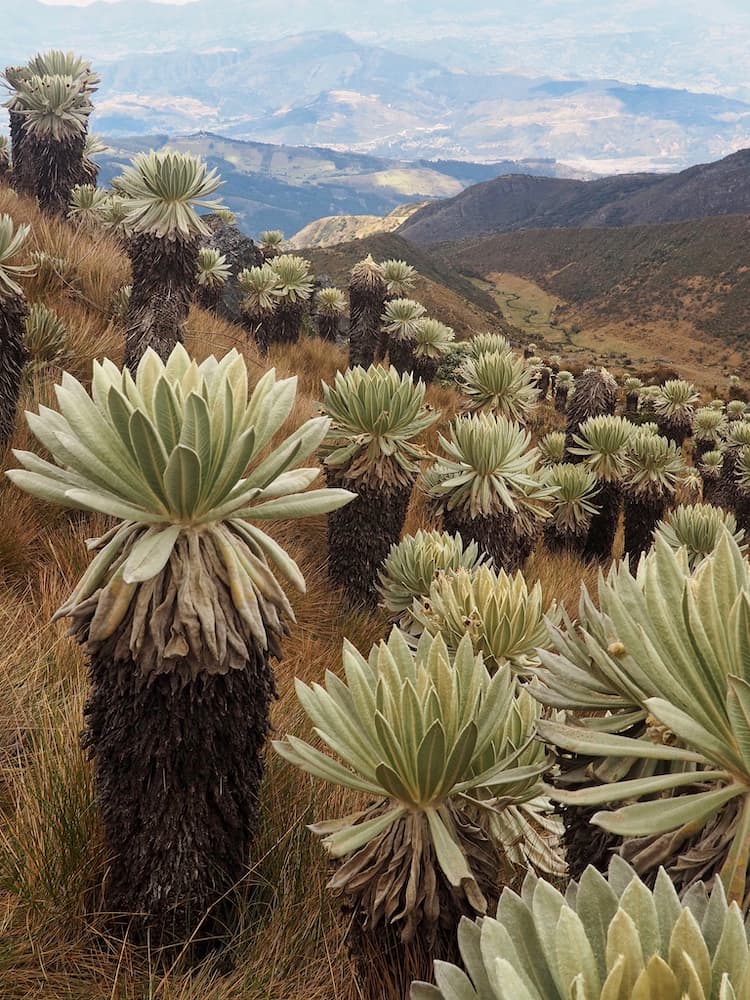
The world’s most beautiful páramo
Following a long flight from Isolation Central, we touch down in Bucaramanga, capital of Colombia’s Santander region. And then it’s straight on to the first of three buses as we head off for the mountain pueblo of Monguí in the extreme north of the Andes.
Translated from the indigenous Muisca language as The Wife’s Bath, it’s a high-altitude town boasting gorgeous Spanish colonial-era architecture.
But it’s the incredible wetlands of the Páramo de Ocetá that we’ve come to see. A fifteen-kilometre round trip hike from the centre of town, ascending 1000 metres in the process, it’s a wondrous landscape of open moorland pitted with huge moisture-retaining plants called frailejones.
You’ll be glad of the muscle rub you brought with you once you’ve taken off your hiking boots at the end of it all. You did remember to bring it, didn’t you?
Discover your inner Indiana Jones
Suitably refreshed after overnighting in Monguí, we catch another couple of buses to Bogotá before continuing on the long journey down to San Agustín in Colombia’s southwest.
There we hire horses and ride through a stunning lush green landscape of coffee plantations, waterfalls and river valleys. And, while we do so, we seek out and gaze upon dozens of mysterious prehistoric statues, tombs and terraces erected by an ancient North Andean civilisation some 2000 years ago.
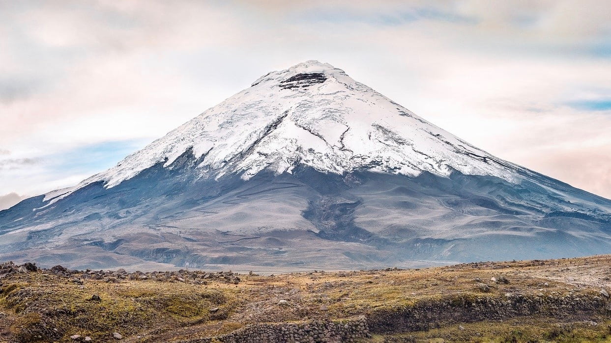
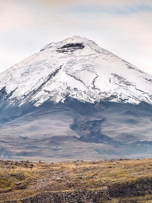
One of the world’s highest active volcanoes
The next day, we take a morning bus from San Agustín across a mountainous and pot-hole-ravaged road to Popayán where we catch a four-hour flight to Quito, the capital of Ecuador.
Our fingers are tightly crossed for a clear day as the skyline behind the city is dominated by the majestic and iconic Volcán Cotopaxi, a conical volcano that has erupted no less than 79 times. Most recently in 2015.
This time, instead of hiking up to its summit or trotting about on horseback, we opt for a jeep ride up to a car park at 4500 metres before jumping on a bicycle for the 8 kilometre white knuckle ride back down.
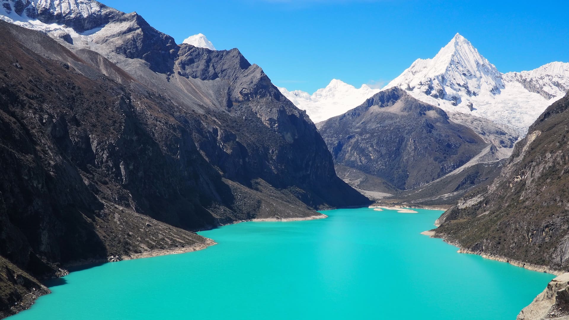
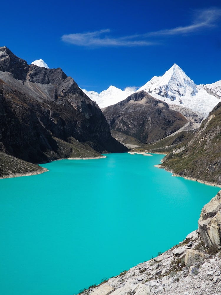
The most beautiful lake you’ve never heard of
Eschewing the 32-hour bus journey to Huaraz in Peru, we instead catch a flight from Quito to Lima, from where we pick up a bus for the eight-hour journey back up north.
And, just when we thought we’d like to take a rest from all that high altitude thin air, we now find ourselves wandering amongst the second-highest mountain range in the world, the Cordillera Blanca.
It’s a land of incredible alpine scenery, brilliant-white glaciers and ultra-blue glacial lakes. Typified beautifully by our easily accessible day trip to Laguna Paron in Huascarán National Park.
With an impossibly mineral-rich expanse of turquoise water set against a backdrop of jagged snow-covered peaks, it’s a photographer’s dream.
And that pyramid-shaped snowy peak we can see at the back of the lake? That’ll be Mount Artesonraju, which served as the inspiration for the iconic Paramount Pictures logo.
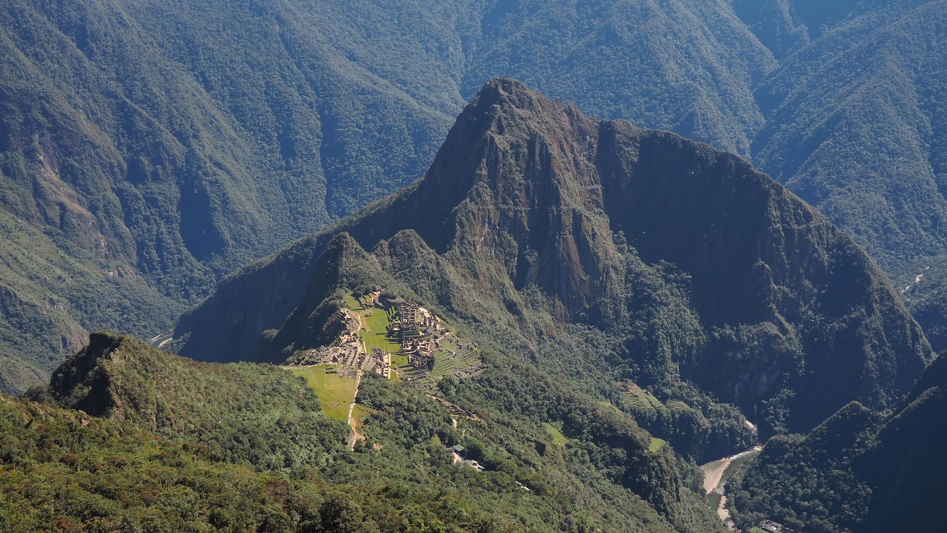
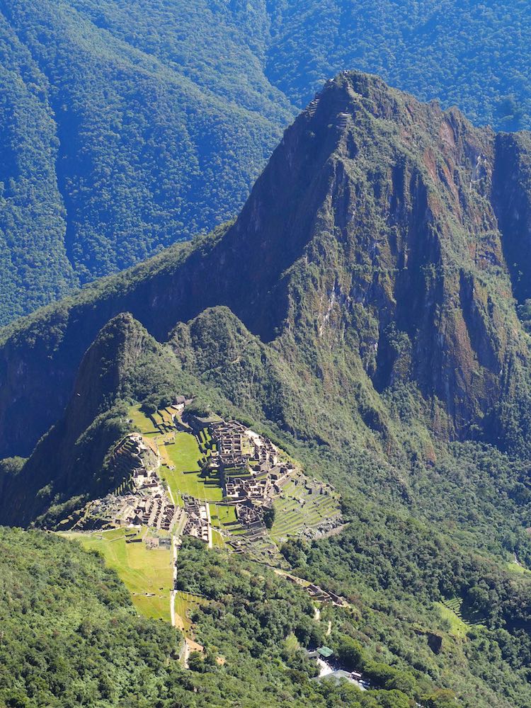
The world’s most famous archaeological site
After taking the overnight bus back to Lima we jump on an internal flight to the ancient Inca capital of Cusco, gateway to the Sacred Valley and Machu Picchu.
Because money’s no object on our virtual tour, we splurge a little and book ourselves on to the Belmond Hiram Bingham train to take us from Cusco to Aguas Calientes. Complete with its period Pulman-style carriages.
The following morning we catch the shuttle bus up to the citadel of Machu Picchu, before hiking to the top of Machu Picchu Mountain for what is quite possibly the most iconic view in South America.
All the while, we’ve obsessed about whether we’d be lucky with the weather as much of the time the rugged mountain landscape in these parts is enshrouded in clouds. But we needn’t have worried. The first rays of the sun greet us as we arrive at the citadel gates at dawn. And, very soon, the ghostly shadows cast by the imposing peaks give way to brilliant green jungle and clear blue skies.
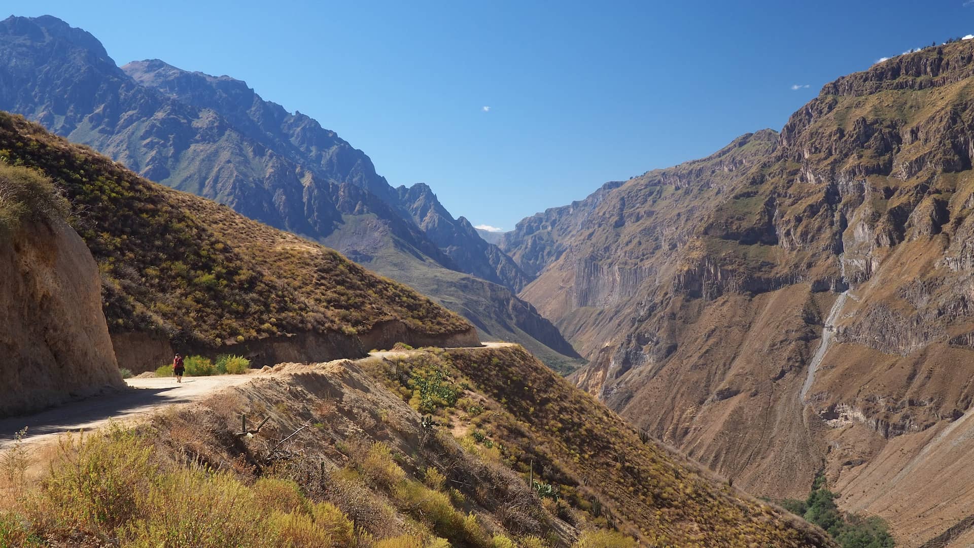
The world’s second-deepest canyon
After taking a more modest train back to Cusco, we head west by bus to the beautiful city of Arequipa. Built from the pink, volcanic stone of the surrounding area, it’s a fabulous place to rest for the night, sip one or two pisco sours and enjoy the superb local food.
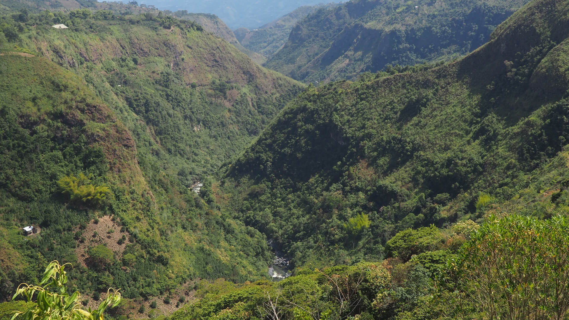
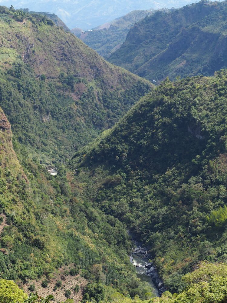
The next day we catch an early-morning bus for the six-hour journey to Cabanaconde and the Colca Canyon. It’s the second-deepest canyon in the world, which means that it even dwarfs that famous one in Arizona.
Not a place to be rushed then. So we pick up our hiking map and walking poles from our accommodation at the Pachamama Hostel for the three-day hike down to the bottom of the canyon and back up again. Stopping off along the way to rest aching muscles in hot thermal baths alongside the Colca River.
But, before we leave, we stop off at the Cruz del Condor viewpoint to watch in amazement as huge Andean Condors take flight from their nests to soar on the early morning thermals.
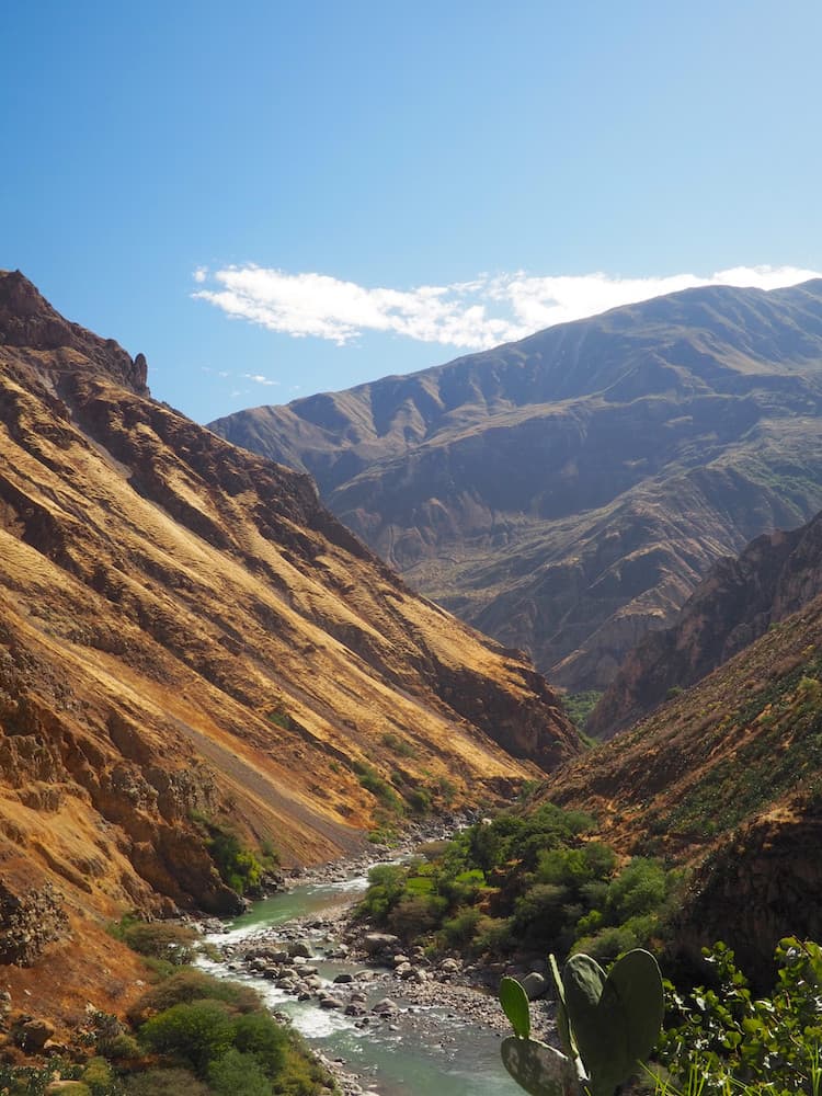
The Río Colca runs through the canyon
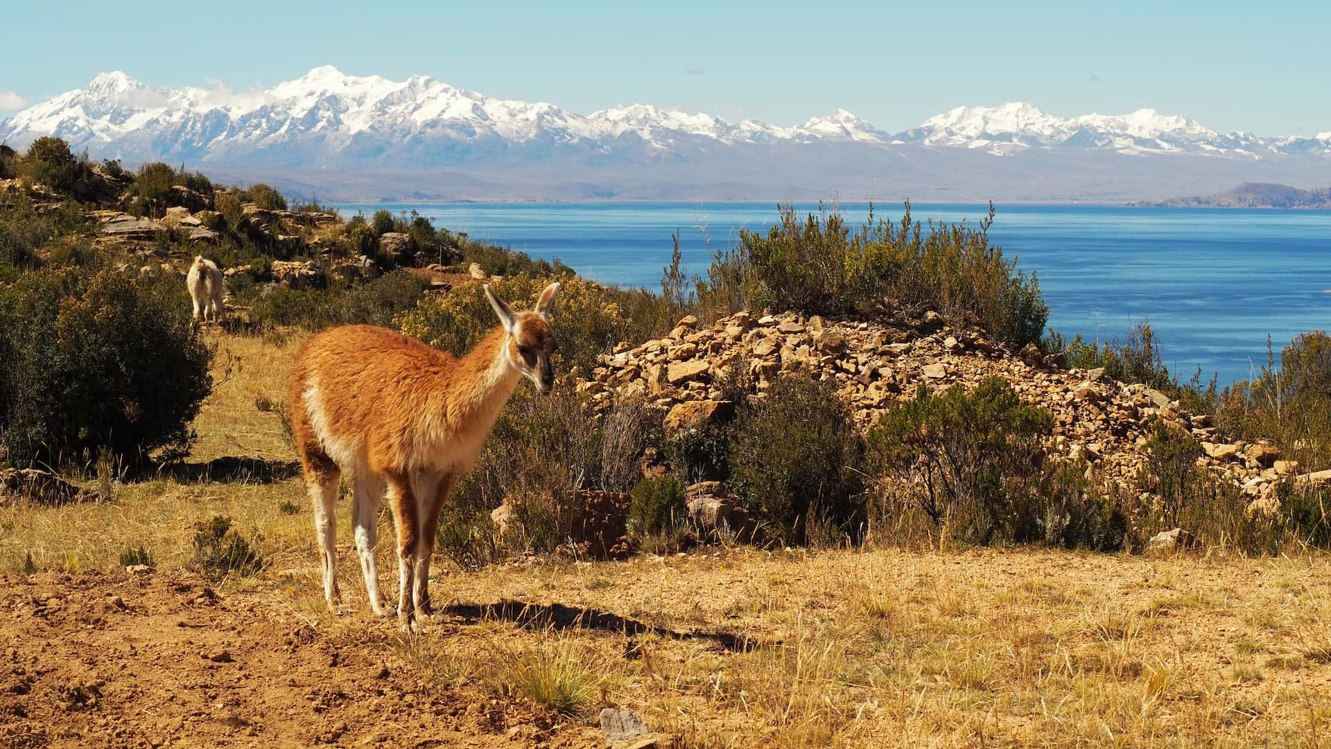
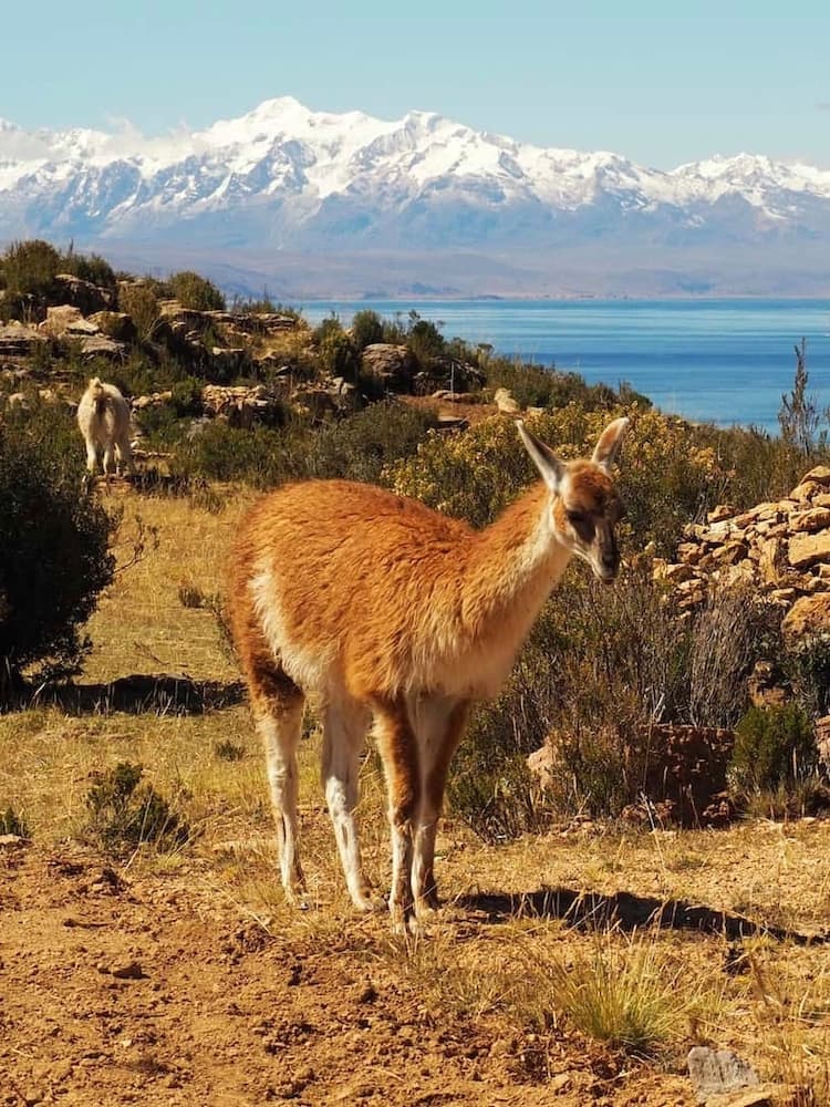
The world’s highest navigable lake
Back in Arequipa, we catch an overnight tourist bus to Lake Titicaca, crossing over into Bolivia and the lakeside town of Copacabana.
At an altitude of 3,800 metres, it’s the highest navigable lake in the world. And so we jump on a ferry to takes us to Isla del Sol, a road-free island on the lake which is said to be the birthplace of the Incas.
After clambering up the steep Inca Steps to our accommodation in Yumani, we wander along the footpaths that stretch along the coastline. All the while, trying to catch our breath in the energy-sapping high altitude.
But the views across the lake to the snowy mountains of the Cordillera Real make the effort thoroughly worthwhile.
A pink lake with pink flamingoes
There’s no time to rest though as we’ve got a four-day road trip odyssey through some of the most sublime scenery on the planet to get on with.
We continue by tourist bus to the city of La Paz, where we catch an internal flight to Tarija in the far south of the country. And then it’s a hair-raising five-hour minivan journey to the desert town of Tupiza.
Notorious for being the place where Butch Cassidy and the Sundance Kid were mowed down by The Law at their desert holdout, it’s the starting point for a wild four-wheel-drive jeep tour of Bolivia’s “southwest circuit”.
One of the highlights is the unbelievably colourful Laguna Colorada. A mixture of pink and red hues, the shallow lake is a favourite haunt for three types of flamingo and the ubiquitous herds of llamas.
After which, our camera batteries completely discharge with overuse and so we head off to stay the night at a hostel built entirely from salt.
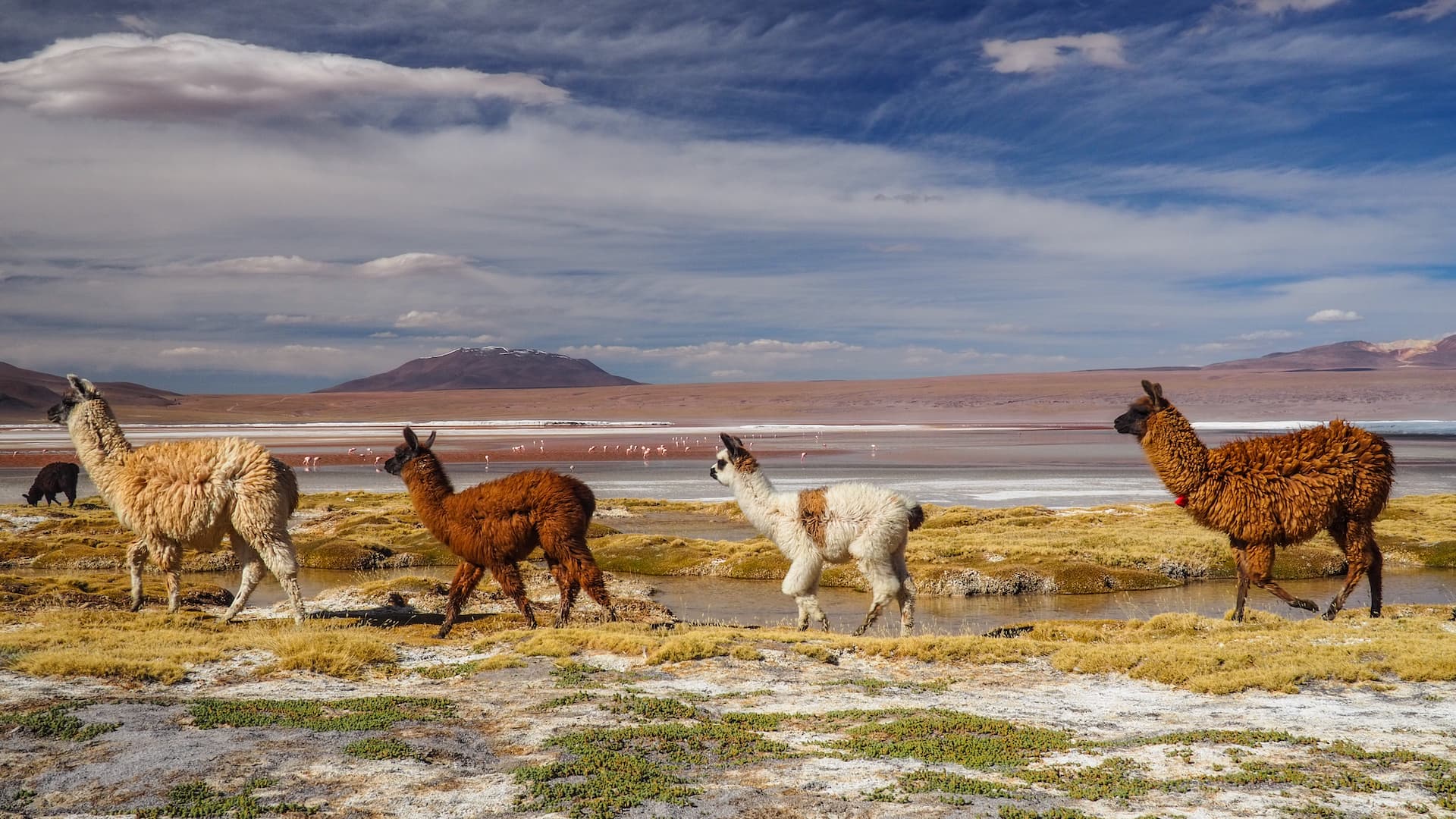
A family of llamas take a stroll beside the shallow waters of Laguna Colorada
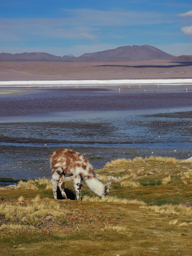
A baby llama grazing on the lake shore
The world’s largest salt flat
And the reason for that salt is the nearby Salar de Uyuni (or Uyuni Salt Flats). Indeed, we’re awoken from our saline-induced slumber before dawn and set out in our jeep across the vast openness of the salt flat. Our destination is the cactus-filled rocky outcrop of Isla Incahuasi to witness the sunrise casting an ethereal glow over the otherworldly landscape.
And then it’s onwards for some high jinks taking perspective-defying photographs of each other before we finish our tour at the town of Uyuni.
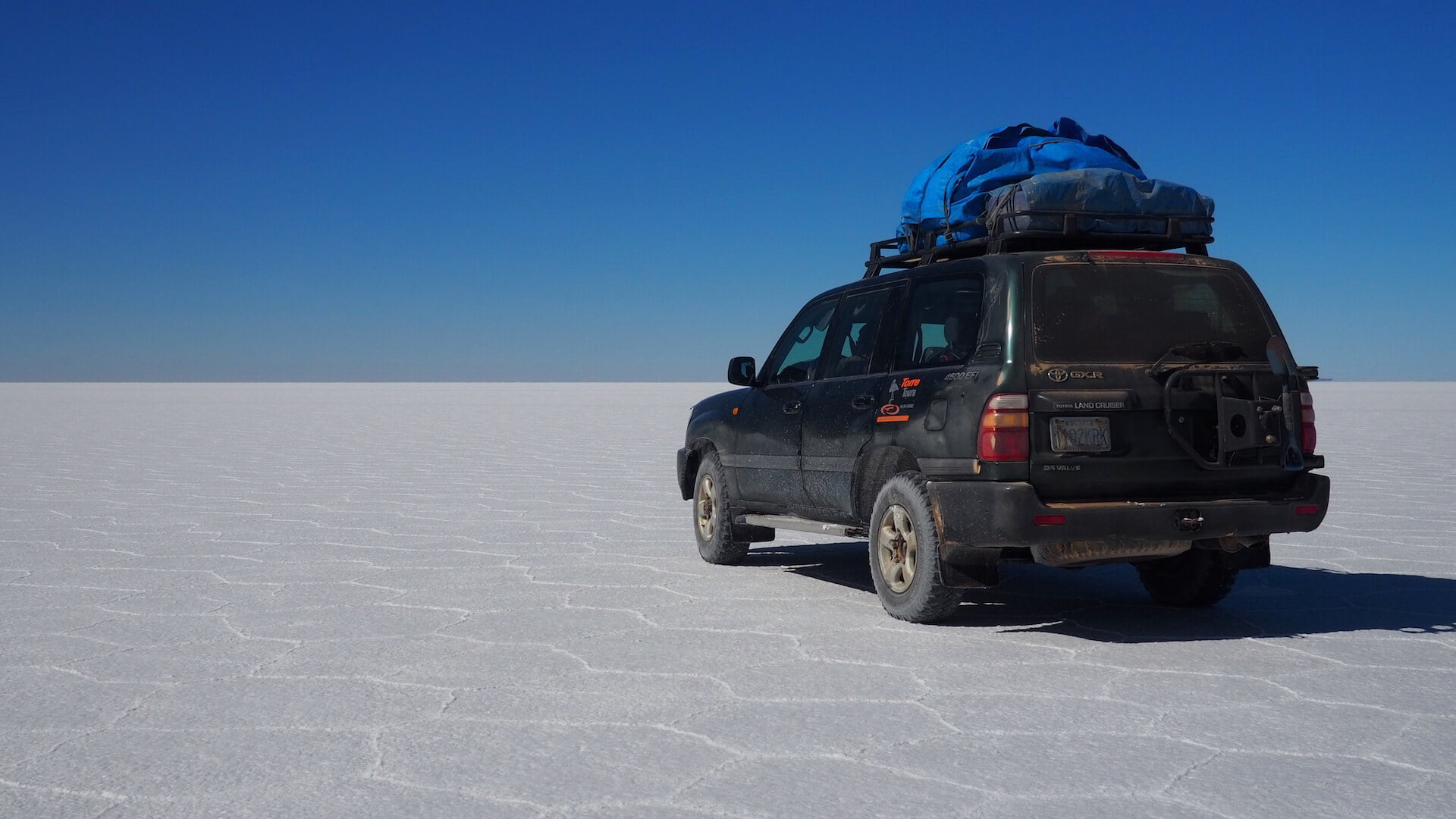
The vast salty space of the Salar de Uyuni
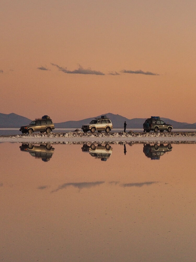
Tour jeeps are perfectly reflected in the shallow waters covering the salt flats at sunset
Multi-coloured mountain landscape
Not a place to hang around in for long, we leave Uyuni almost immediately and take a minivan across the border to Chile and San Pedro de Atacama. It’s here that we say goodbye to public transportation to pick up our camper van. It’ll be our home for the remaining 4500 kilometres (2800 miles) of our journey so we buy a couple of extra pillows. Better safe than sorry.
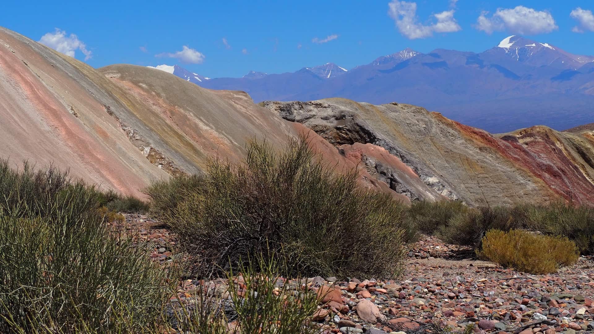
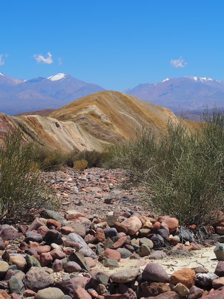
Without further ado, we head eastward through the Atacama Desert to the Argentinian border and down into the Quebrada de Humahuaca. It’s a staggering landscape of red rocks, huge cacti and multi-coloured mountains. None more so than Serraniá de Hornocal, which at 4300 metres is a gasp-inducing spectacle for a number of reasons.
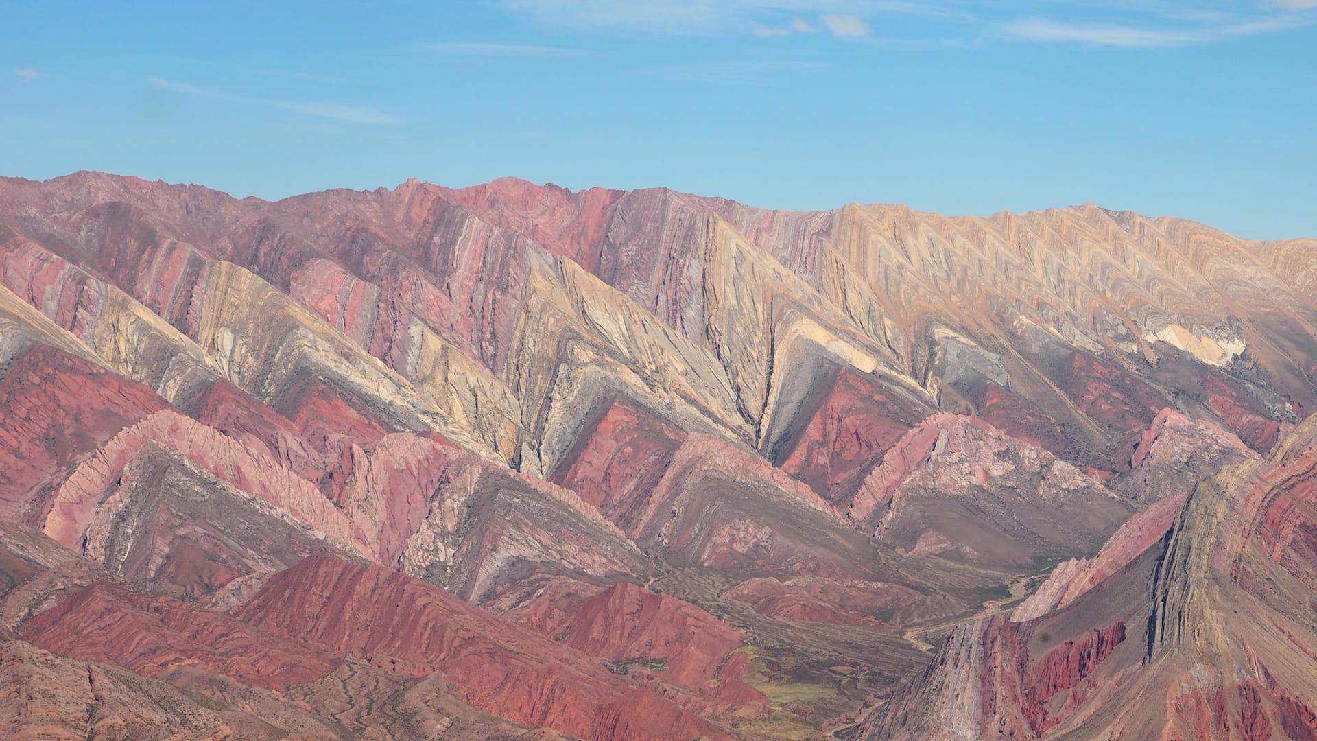
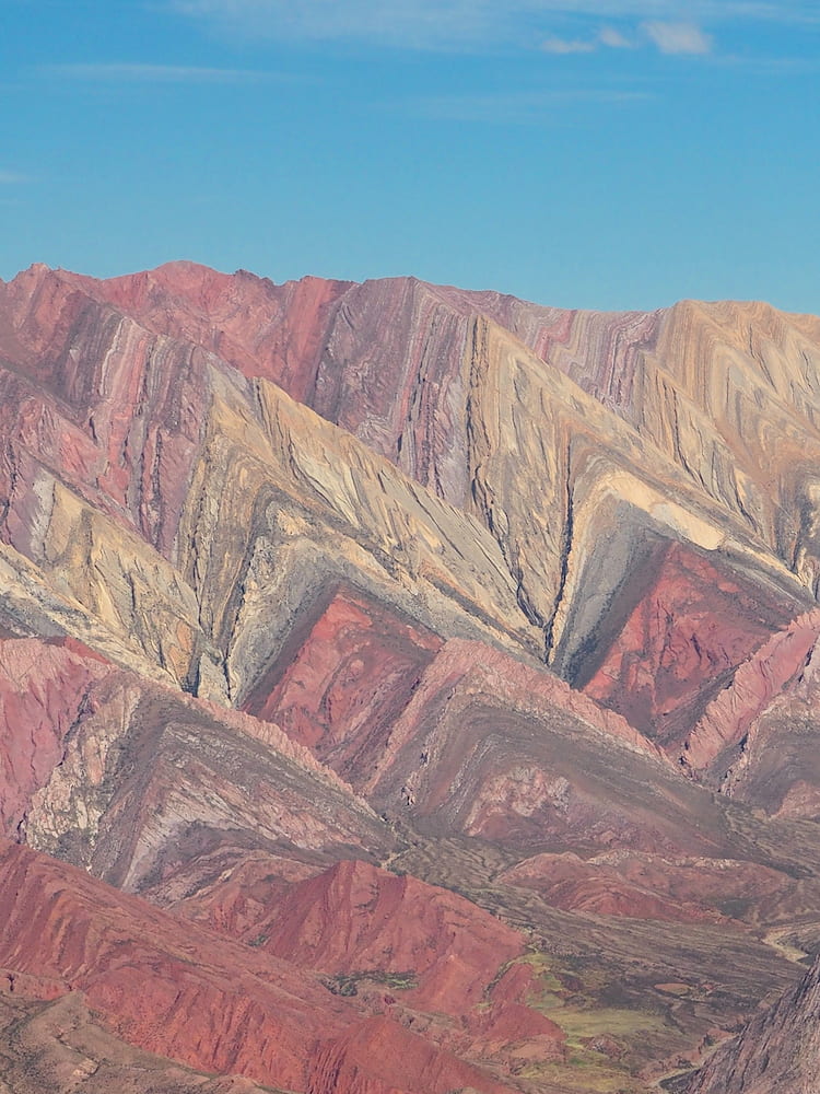
Sandstone mountains and green valleys
From here it’s a continuous journey south, following the spine of the Andes along the infamous roads of Argentina’s Ruta 40 and Chile’s Carretera Austral.
From the Quebrada de Humahuaca we bypass the Andean heritage town of Salta before passing through the red rock formations and green pastures of the Quebrada de Cafayate.
The payoff is in store when we finally arrive in Cafayate, northwest Argentina’s wine-producing capital. Time then to explore the town’s wineries and sample the best Torrontes we’ve ever tasted. Even the ice cream is made with it.
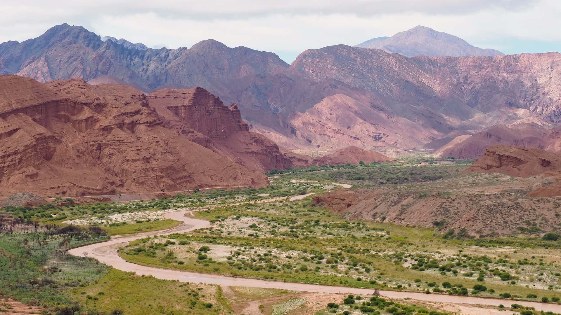
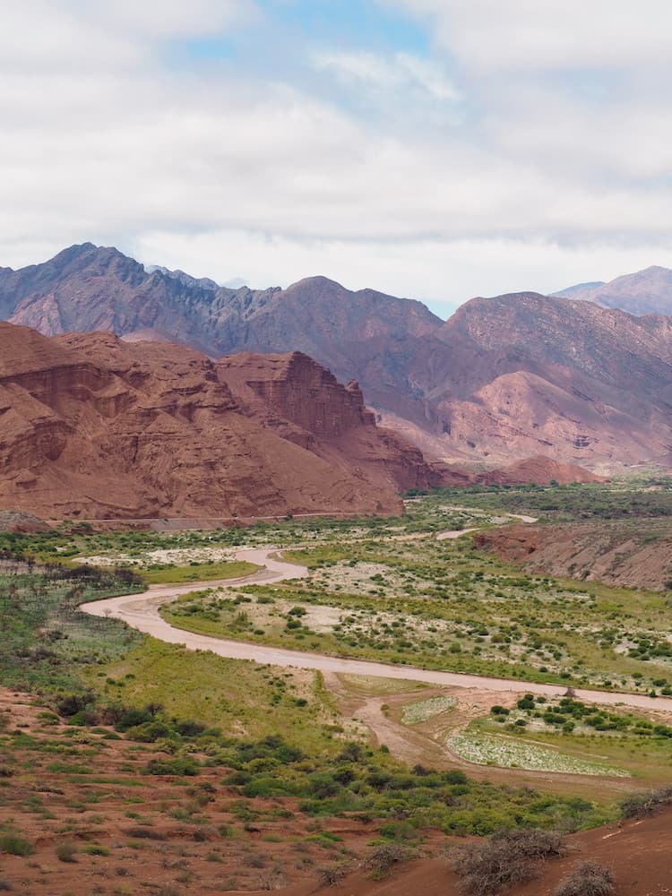
The High Andes separating Chile from Argentina
From Cafayate down to Barreal, 1000 kilometres south, the desert scenery resembles a John Ford western on a monumental scale.
In fact, the landscapes are so vast and rugged that it’s easy to imagine herds of enormous dinosaurs roaming freely around us. Which apparently they did back in the day, as evidenced by the extensive remains in Parque Nacional Talampaya.
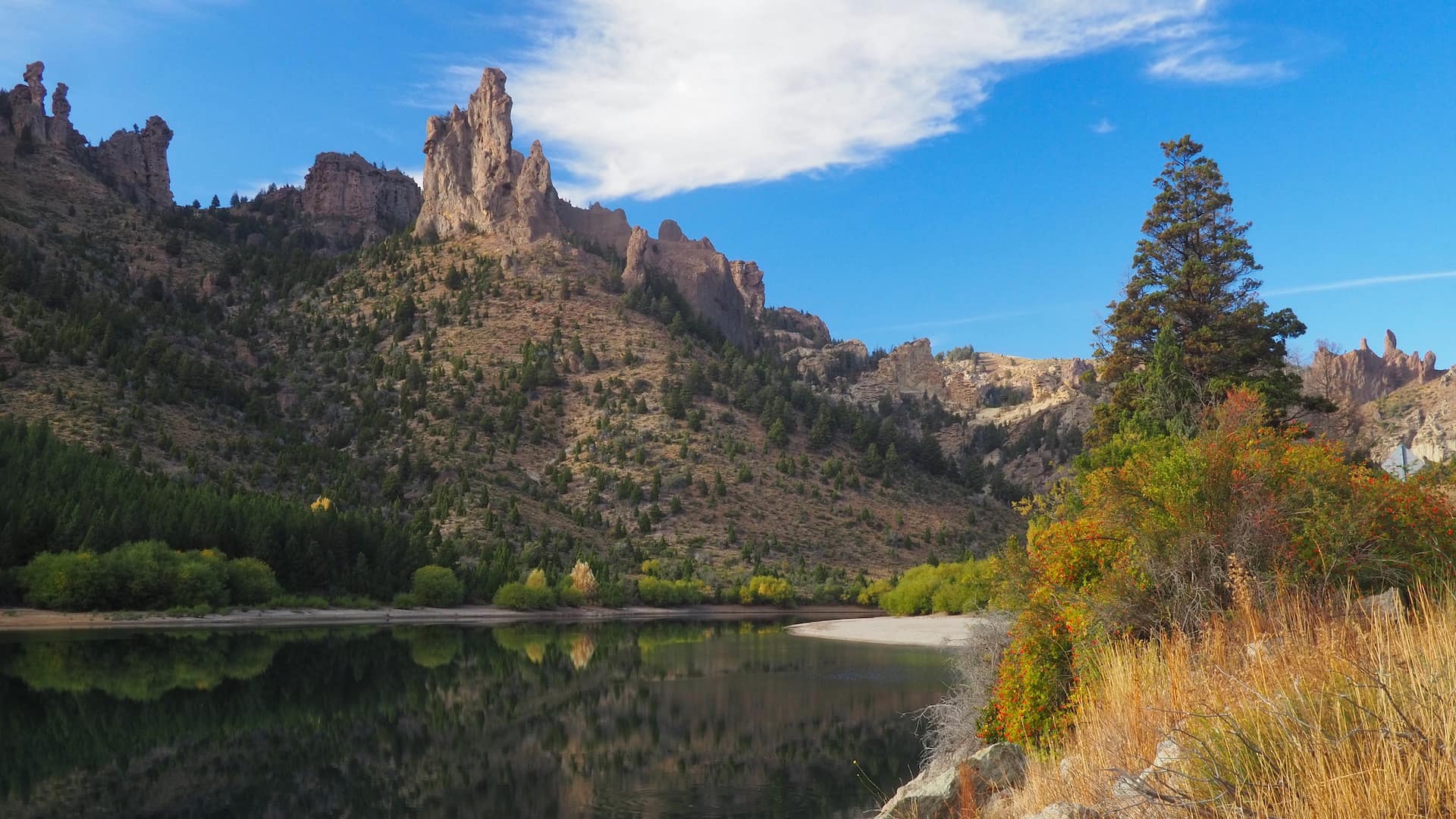
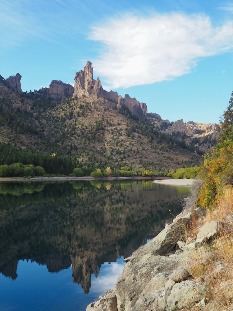
Eventually, after several nights of wild desert camping, we arrive at Barreal. With views across to the mighty Cordillera de Ansilta range that separates Argentina from Chile, it’s a place to slow down for a while before moving on.
View of the Cordillera de Ansilta from The Valley Of Seven Colours
View of the Cordillera de Ansilta from the Valley of Seven Colours
Argentina’s lake district
Continuing south, we bypass Argentina’s other wine-producing region of Mendoza and head towards Parque Nacional Nahuel Huapi in northern Patagonia.
Home to one of Argentina’s most up-market holiday resorts, Bariloche, it’s a lake-filled region of striking beauty. And perfect for lakeside BBQs from our camper van with the odd bottle of Mendoza Malbec.
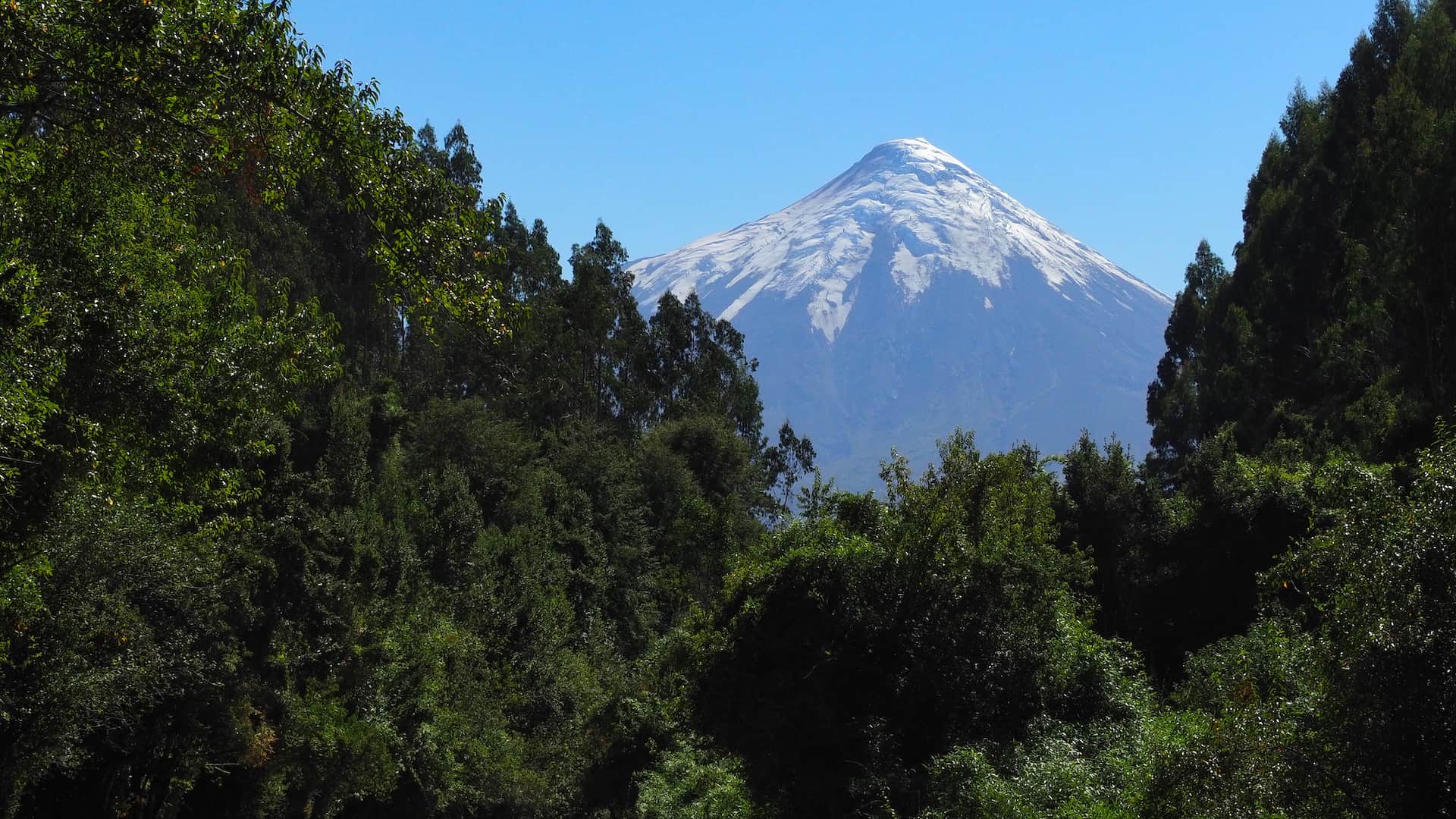
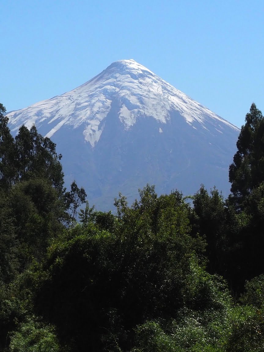
Perfectly conical volcano in Chile’s lake district
We now head westward and across the border to the Chilean side of what’s commonly known as the Lake District.
We’ve also entered a region that’s rich in volcanoes, some of which have been recently active to devastating effect. One of the most picturesque is the conical Volcán Osorno, which separates the twin lakes of Todos los Santos and Llanquihue.
The Marble Caves of Chilean Patagonia
And then it’s onwards towards the Carretera Austral, the notorious gravel road constructed by Genera Pinochet’s regime in an attempt to connect north and south Patagonia. Nowadays, much of it has been paved. But it remains one of the world’s best road trips.
We spend several days driving along its mountainous route, stopping occasionally to hike to smoking volcanoes, hanging glaciers, and glacial lakes. Eventually, we arrive at Puerto Rio Tranquilo, on the shore of Lago General Carrera, to take a short boat ride to see the revered Capillas de Mármol.
These strikingly coloured caves are the handiwork of thousands of years of wind-powered waves carving into a peninsula of solid marble. And they’re a photographer’s wet dream.
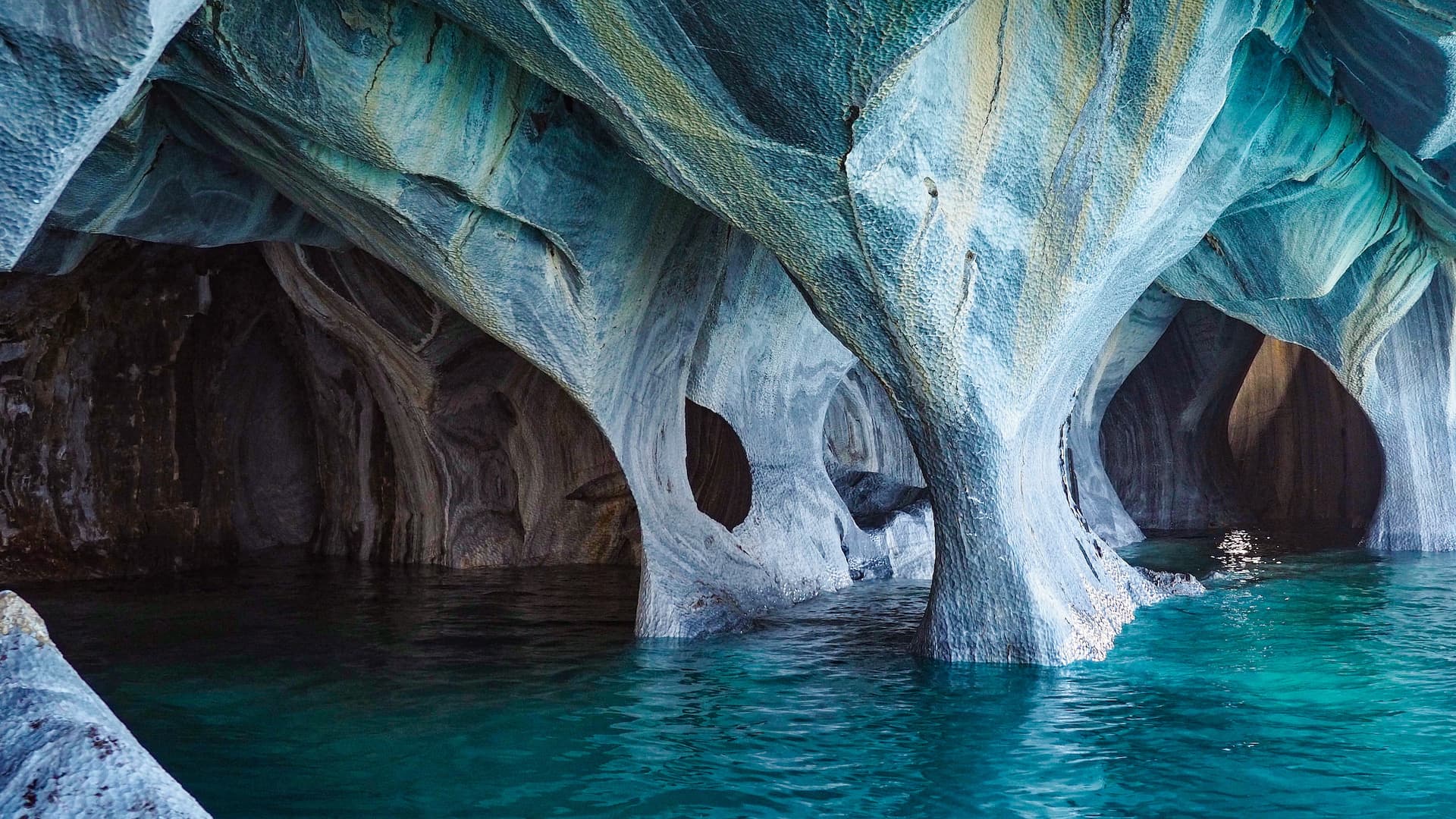
Inside The Cathedral – the most spectacular of the Marble Caves
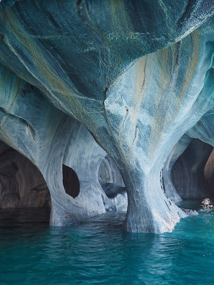
Inside The Cathedral – the most spectacular of the Marble Caves
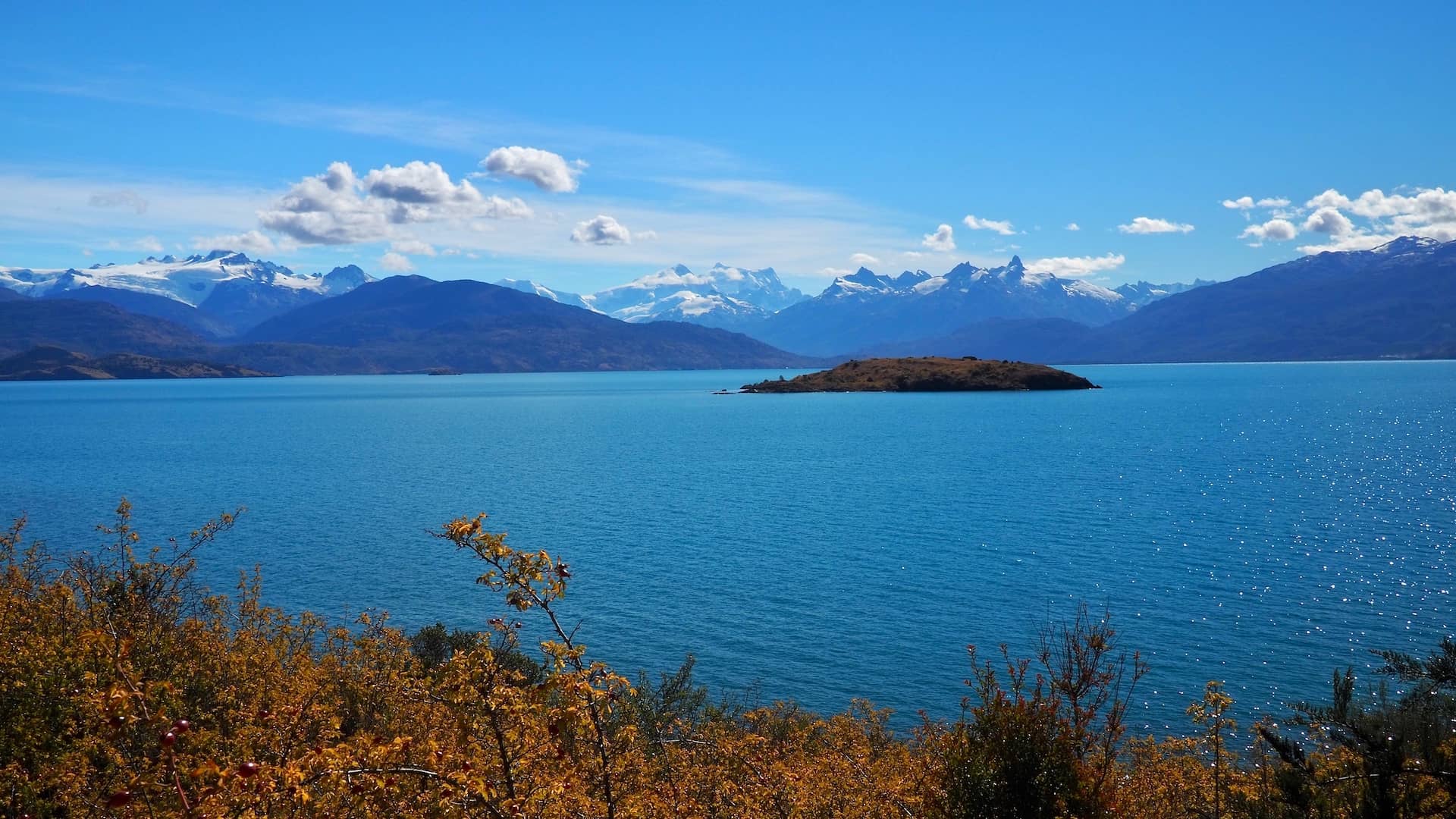
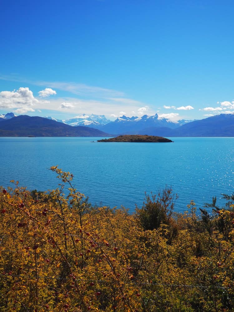
Chile’s largest lake
Indeed, the whole area surrounding Lago General Carrera, Chile’s largest lake, is extremely photogenic. And, as we leave the Carretera Austral and head back towards the Argentinian border, we make a point of stopping wherever we can to take in the scenery.
As in this viewpoint near to Puerto Guadal.
The jewel of southern Patagonia
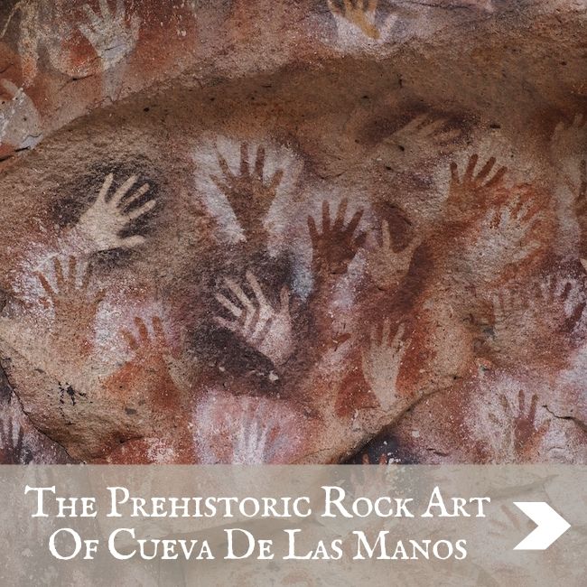
Once we’ve crossed back over into Argentina at Chile Chico, we eventually rejoin Ruta 40 for the long drive south through relentlessly dry steppe. Only stopping for a side trip to see the fascinating prehistoric hand paintings of Cueva de las Manos. Otherwise, there’s little incentive to stop.
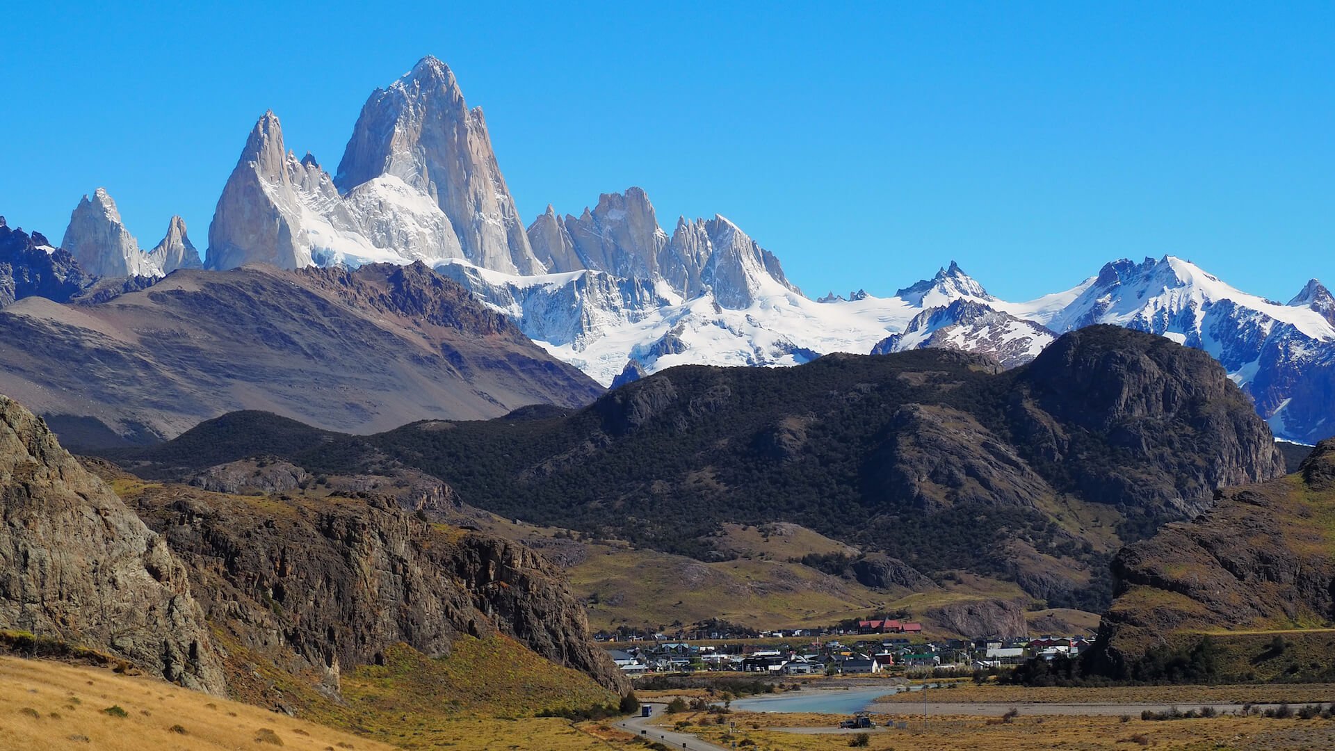
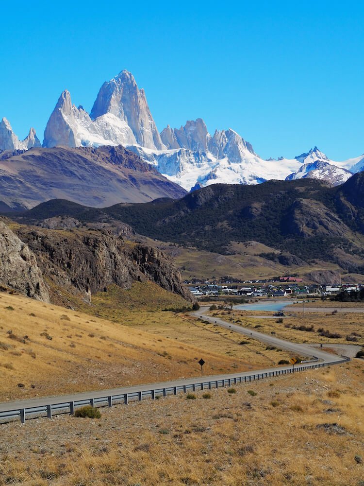
So we battle on over increasingly brutal gravel until we find the turnoff for El Chalten, Argentina’s frontier town for southern Patagonia. Happily, the road leading to El Chalten is quite simply the most dramatic stretch of tarmac imaginable.
Having left the monotonous grey flatness of the steppe behind, the landscape is now transformed into one of craggy mountains, lakes, forests and glaciers. And, all the while, the imposing drama of Mount Fitz Roy and Cerro Torre’s triple towers plays out in front of us, increasingly filling our view as we inch nearer.
We’ll hang around El Chalten for a few days as the hiking here is some of the best in the whole of Patagonia.
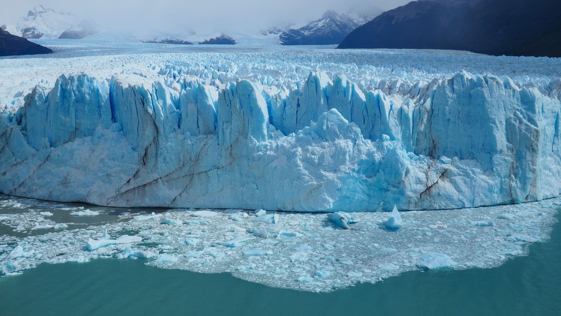
Mind-blowing glacier that is still advancing
But if you thought that was dramatic, wait until you see what’s in store at our next destination.
It’s a three-hour drive from El Chalten to El Calafate, which serves as a gateway to the colossal Perito Moreno Glacier. It’s one of the few glaciers in the world that’s still advancing rather than retreating. And we’ll not only be able to appreciate its sheer scale from close-up vantage points, but we’ll also be donning crampons to hike on the glacier itself.
Despite everything we’ve already seen on this epic Andean journey, this might just be the spectacle that tops them all. And any doubts are erased completely when we witness a huge chunk of ice the size of a house dislodge from the glacier wall and crash into the lake below.
Just mesmerising.
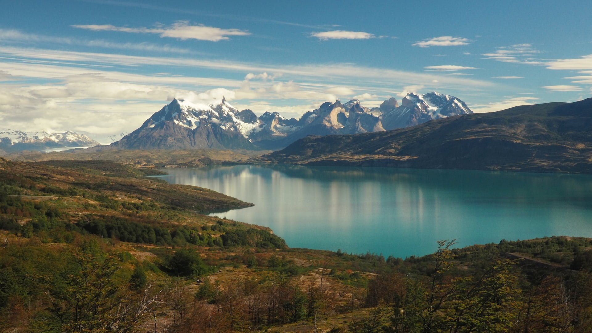
Patagonia’s hiking capital
And, finally, we head back into Chile for our final destination, Parque Nacional Torres del Paine. Patagonia’s ultimate playground. Time for one last hike amongst stunning scenery.
By now, the overland journey in our camper van all the way from the deserts of northern Chile has taken its toll. We’re cold and lacking in sleep. Our bones are in need of some respite from the rutted gravel roads of the past few days. And the pillows we bought at the beginning have now been reduced to a lumpy, uncomfortable mess.
But we’ve not come this far to give up now. We awaken to an extra-strong mug of coffee and stiffen ourselves for one final challenge.
As we hike, we reminisce about what we’ve witnessed on this incredible journey through the length of the Andes Mountains.
And we wonder if we’ll see anything to remotely match it ever again.
What did you think? Have you been to the Andes Mountains? Or perhaps you’re thinking of visiting there in the near future? Either way, we’d love to hear from you so please add your comments below.
MORE ON THE ANDES
Flights
Travel insurance
Visas
Rooms
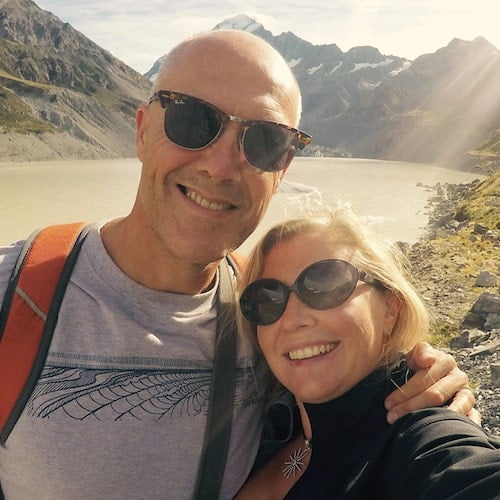
Hi, we’re Ian and Nicky, an English couple on a voyage of discovery around the world, and this blog is designed to reflect what we see, think and do. Actually, we’d like to think it also provides information, entertainment and inspiration for other “mature” travellers, too. So please feel free to pour yourself a glass of something suitably chilled and take a look around.
Totally spectacular you guys. Just awesome!
Thanks, both – glad you enjoyed it!