FROM SENNEN COVE TO LAND’S END: A WALK ON THE WILD SIDE
8 January 2022
FROM SENNEN COVE TO LAND’S END: A WALK ON THE WILD SIDE

8 January 2022
A visit to Cornwall, southwest England’s holiday playground, featuring award-winning beaches, lung-busting coastal walks and artery-clogging local delicacies, should always culminate in a trip to Land’s End.
Not that there’s much there to see. Sure, the scenery is gorgeous enough – as much of the rest of Cornwall’s coastline is. And, if you’re up for some tacky commercialisation of a national landmark, then you won’t be disappointed.
But mostly it represents a pilgrimage-of-sorts for domestic tourists eager to soak up mythical Arthurian tales of sunken kingdoms and family infighting. Or to at least return home with a photograph to show they’ve stood at the southwest extremity of mainland Britain. Just like countless thousands before them, who’ve gazed out over the cliffs and crashing waves towards the faint cliffs of the Scilly Isles beyond.
Most visitors rock up at the landmark’s dedicated car park and access the headland via the tourist village. But, for a more visceral experience, we’d recommend making your way to nearby Sennen Cove and approach Land’s End by walking along the coastal path.
Here’s what you can expect.
Land's End
Sennen Cove
About Land’s End
What is now called Land’s End was originally known by the Ancient Greeks as Belerion (translated as “Shining Land“ or Place of the Sun”). Which would suggest that the Ancient Greeks had a good sense of irony given the doubtful nature of the English weather.
Its current moniker was coined in the 16th Century from the Cornish Penn An Wlas – or “End of the Land”. Indeed, its headland sits at one of Britain’s two extreme points – the other being John O’Groats in Scotland, some 874 miles further north.
However, if you believe the legend, the 28 miles between Land’s End and the Scilly Isles were once occupied by The Lost Land of Lyonesse. It was here that King Arthur was allegedly slain by his traitorous nephew, Mordred. And then, centuries later, lost forever when a catastrophic flood condemned it to the depths of the sea.
In its place, the weather-worn cliffs of present-day Land’s End tower over a multitude of sea stacks, rock arches and offshore islands.

Walking from Sennen Cove
The beach at Sennen Cove is wild, clean and inviting. As Cornwall’s most westerly beach, it’s also a haven for surfers. So, after a brisk walk to and from Land’s End, it’s an ideal place to catch up on some Cornish relaxation.
But, for now, we head towards the harbour, where there’s a car park at the bottom of the coastal path.
From the back of the car park, the path ascends steeply for about 10 minutes. And, as we climb, we look back across the harbour towards Sennen Cove and Whitesand Bay. We can just make out the black bodysuits of the first surfers of the day as they brave the chilly water of the Celtic Sea.

Whitesands Bay, Sennen Cove
Mayon Cliff Old Coastguard Lookout
Having reached the top of the path at Mayon Cliff, we take a brief detour to the Old Coastguard Lookout. Built in 1891, it played a part during the First World War when local men were recruited to help the coastguard watch for German U-Boats marauding in the waters below.
Nowadays, it serves as the first opportunity to view Land’s End from the west. And, slightly out to sea, the Longships Lighthouse, standing proud on its own rocky reef.

View towards Land’s End from the lookout
The Mayon Cliff Shipwreck
Further along the path, we discover the remnants of a calamitous shipping accident on the rocky beach below. One foggy morning in 2003 the German cargo ship, RMS Mülheim, ran aground after the ship’s chief officer – whose job it was to keep watch – managed to render himself unconscious when he caught his trousers on a chair and fell. When he awoke, it was already too late. RMS Mülheim became the latest in a long line of ships to have met their demise over the perilous reefs.
The subsequent years have seen the forces of nature slowly dismantle the wreck. To the point where it’s best viewed from above rather than trying to get too close to the sharp, twisted metal of its carcass.

The remains of RMS Mülheim
Beyond, the footpath passes a variety of large boulder formations, which make for dramatic counterpoints to the views over the cliffs towards Longships Lighthouse. In our opinion, this is the loveliest part of the Land’s End experience. It’s where the coastline is at its most dramatic. And, away from the crowds at the landmark itself, it at least feels like you’re in a remote outpost of England rather than a tourist destination.
")
And then, a mere forty-minutes-or so after leaving Sennen Cove car park, the path gently descends toward an isolated white building with a grey, slate roof, which appears to be perched on the edge of the cliffs. It’s the famous “First and Last House in England”, home to a souvenir shop since Victorian times. Although the original simple piece of granite, stamped with “Land’s End”, is no longer the only souvenir on offer.
As we approach we can’t help but think how wonderful it would be if it was actually the “First and Last Pub in England” instead. Sadly, that particular claim to fame belongs to a pub in the village of Sennen.

Approaching Land’s End with the Longships Lighthouse in the background
At Land’s End
Beyond the building, a short path takes us to the cliffs and a lookout over offshore sea stacks. We imagine them as giant footsteps leading down to the watery depths of Lyonesse.
Of course, we’re now joined by the larger crowds who’ve arrived by car or open-top bus. Indeed, there’s an increasingly busy line of people wandering between here and the tourist village just back up the hill.
We head there ourselves and arrive at the iconic Land’s End signpost. Iconic in that it’s probably the most photographed of all the sights here. If we wished, we could even have our photo taken next to it with the mileage to our home town displayed. But at £12 a pop, we decide it’s a pay-over-the-odds luxury we can easily live without.
However, its iconic status has been cemented by its place as the start or end point for charity walks and cycle rides between Land’s End and John O’Groats.


Then we spot the Land’s End Beacon. It’s a recent (2000) addition that represents a centuries-old tradition of hilltop fires being lit in sequence to signify certain Royal occasions. So, as one hilltop fire is spotted in the distance, the next one is lit and so on (including on the four highest points in England, Scotland, Wales and Northern Ireland). The one at Land’s End was most recently lit to commemorate the Queen’s Diamond Jubilee in 2012.

The Land’s End beacon
The beacon sits at the entrance to the recently-built tourist complex. Featuring a hotel, shopping village, 4D cinema, museum and access to enough cornish pasties, doughnuts and ice cream to feed a small army, it feels like a mini theme park. Which is essentially what it is.
The Longships Lighthouse
We continue on the coastal footpath which again descends to the cliff edge at Carn Greeb. About a mile offshore, beyond a rocky promontory known as the “Armed Knight”, lies the Longships Lighthouse. Built in 1875 and standing 35 metres (114 ft) high, it served as a much-needed warning to mariners.
Back then it was manned by a warden whose nightly task was to light the paraffin lamp before settling down to a quiet evening with a few drams of rum and a smoke-filled pipe (probably). Of course, that was after wishing his family “goodnight” by standing in front of the lighthouse’s white door and signalling messages ashore with the aid of a couple of flags and manic arm-waving. Like a 19th century version of message-by-emoji.
Ah, the romance of it all.
Nowadays, it’s unmanned and lit automatically from Trinity House in Essex

The Longships Lighthouse and The Armed Knight
Return to Sennen Cove
With enough time and fair weather, it’s feasible to continue walking along the coast path to Porthcurno and the world-famous Minack Theatre, before returning to Sennen Cove on the same day. Certainly, there’s enough variety of fabulous coastal scenery along the way to keep anyone entertained.
We decide to visit the latter on another day and retrace our steps to Sennen Cove instead. There’s an alternative route slightly inland along a cycle path to consider. But the different perspectives of the westward clifftop views along the coastal path are much more enticing.
As a result, our visit to Land’s End becomes as much about the surrounding coastline as the landmark itself.
Which, with over 400 miles of walkable coastline to explore, is what Cornwall is all about.


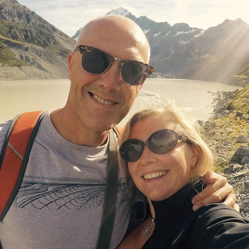
Hi, we’re Ian and Nicky, an English couple on a voyage of discovery around the world, and this blog is designed to reflect what we see, think and do. Actually, we’d like to think it also provides information, entertainment and inspiration for other “mature” travellers, too. So please feel free to pour yourself a glass of something suitably chilled and take a look around.